← Back to All Plates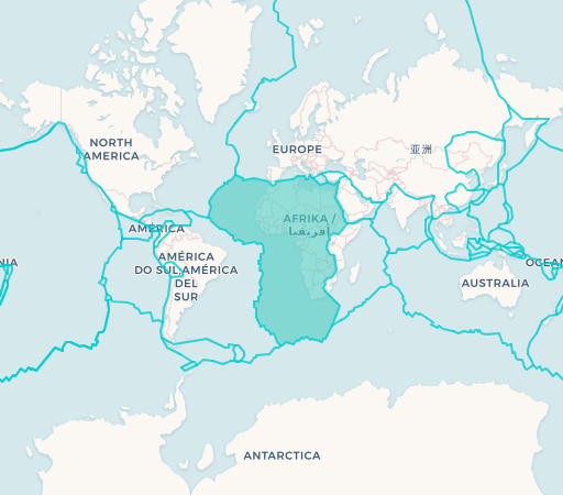
African Plate
The African Plate is a major tectonic plate spanning the entire African continent and extending into the surrounding oceanic crust of the Atlantic and Indian Oceans. It is currently being split by the East African Rift, where the Somali Plate is slowly separating. The plate's northern boundary with the Eurasian Plate created the Alps and Mediterranean features, while its interaction with the Arabian Plate formed the Red Sea rift zone.
Plate Information
Size: 61 million km²
Movement: Northward
Speed: 2.15 cm/year
Countries: 49
Countries & Territories
Algeria
Angola
Benin
Botswana
Burkina Faso
Burundi
Cameroon
Central African Republic
Chad
Democratic Republic of the Congo
Republic of the Congo
Djibouti
Egypt
Equatorial Guinea
Eritrea
Eswatini
Ethiopia
Gabon
Gambia
Ghana
Guinea
Guinea-Bissau
Ivory Coast
Kenya
Lesotho
Liberia
Libya
Madagascar
Malawi
Mali
Mauritania
Morocco
Mozambique
Namibia
Niger
Nigeria
Rwanda
Senegal
Sierra Leone
Somalia
South Africa
South Sudan
Sudan
Tanzania
Togo
Tunisia
Uganda
Zambia
Zimbabwe
Key Facts
- Covers approximately 61 million km²
- Moving northward at about 2.15 cm per year
- Responsible for the Great Rift Valley in East Africa
- Divergent boundary creating the Mid-Atlantic Ridge