← Back to All Plates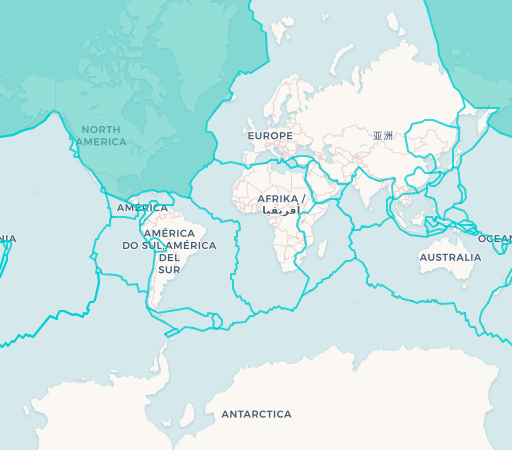
North American Plate
The North American Plate encompasses the North American continent, Greenland, and extends eastward to the Mid-Atlantic Ridge. Its western boundary is marked by the famous San Andreas Fault system in California, where it slides past the Pacific Plate. The plate's divergent boundary with the Eurasian Plate at the Mid-Atlantic Ridge is actively creating new oceanic crust, slowly widening the Atlantic Ocean at a rate of a few centimeters per year.
Plate Information
Size: 75 million km²
Movement: West-Southwest
Speed: 2.3 cm/year
Countries: 9
Countries & Territories
United States
Canada
Mexico
Guatemala (partial)
Belize (partial)
Cuba (partial)
Bahamas
Greenland
Iceland (partial)
Key Facts
- Approximately 75 million km² in area
- Divergent boundary with Eurasian Plate at Mid-Atlantic Ridge
- Transform boundary with Pacific Plate (San Andreas Fault)
- Moving west-southwest at about 2.3 cm per year